
TRapper’s Point | 190.5-Acre Development Land in Fort Lupton, CO
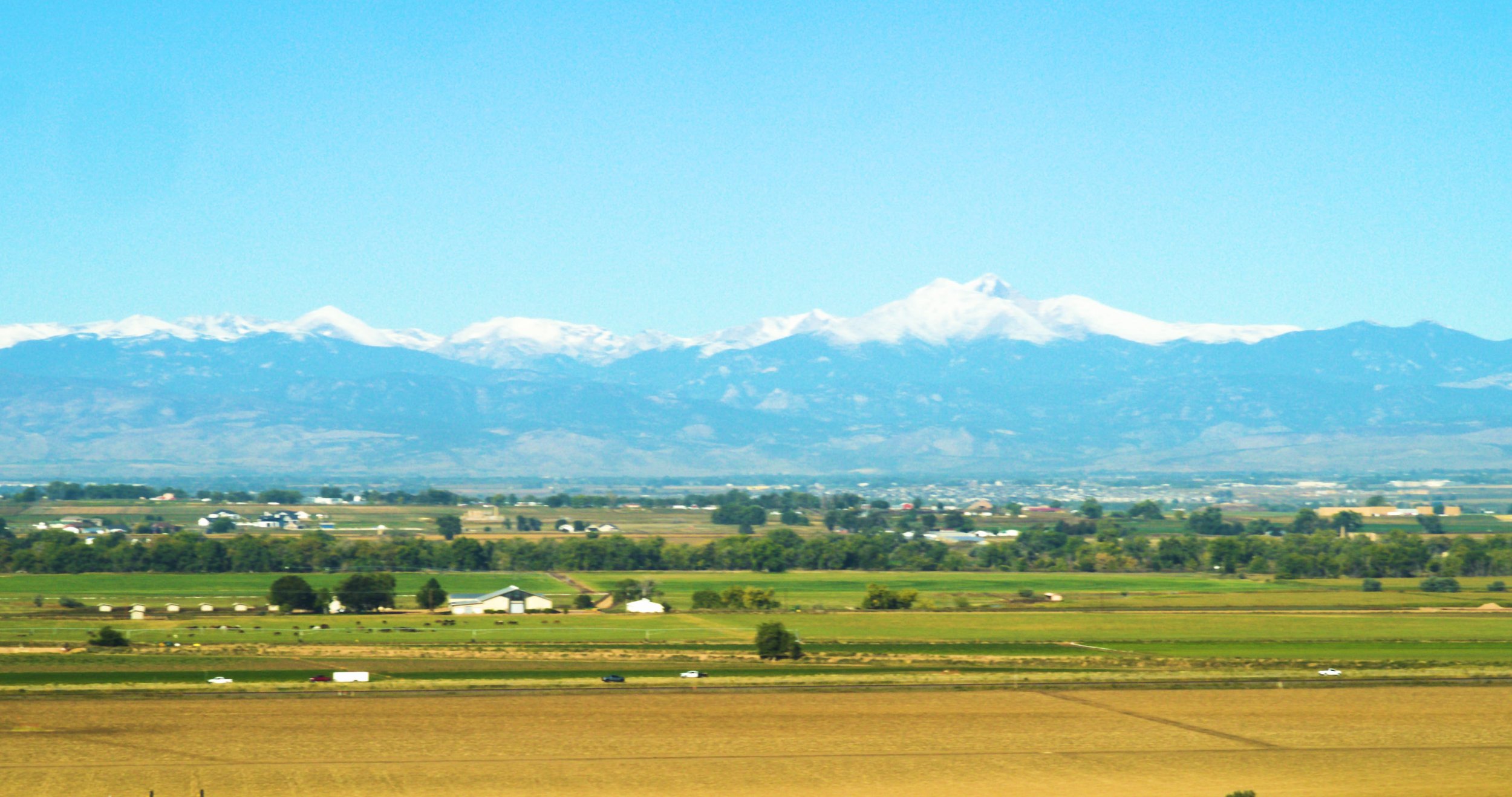
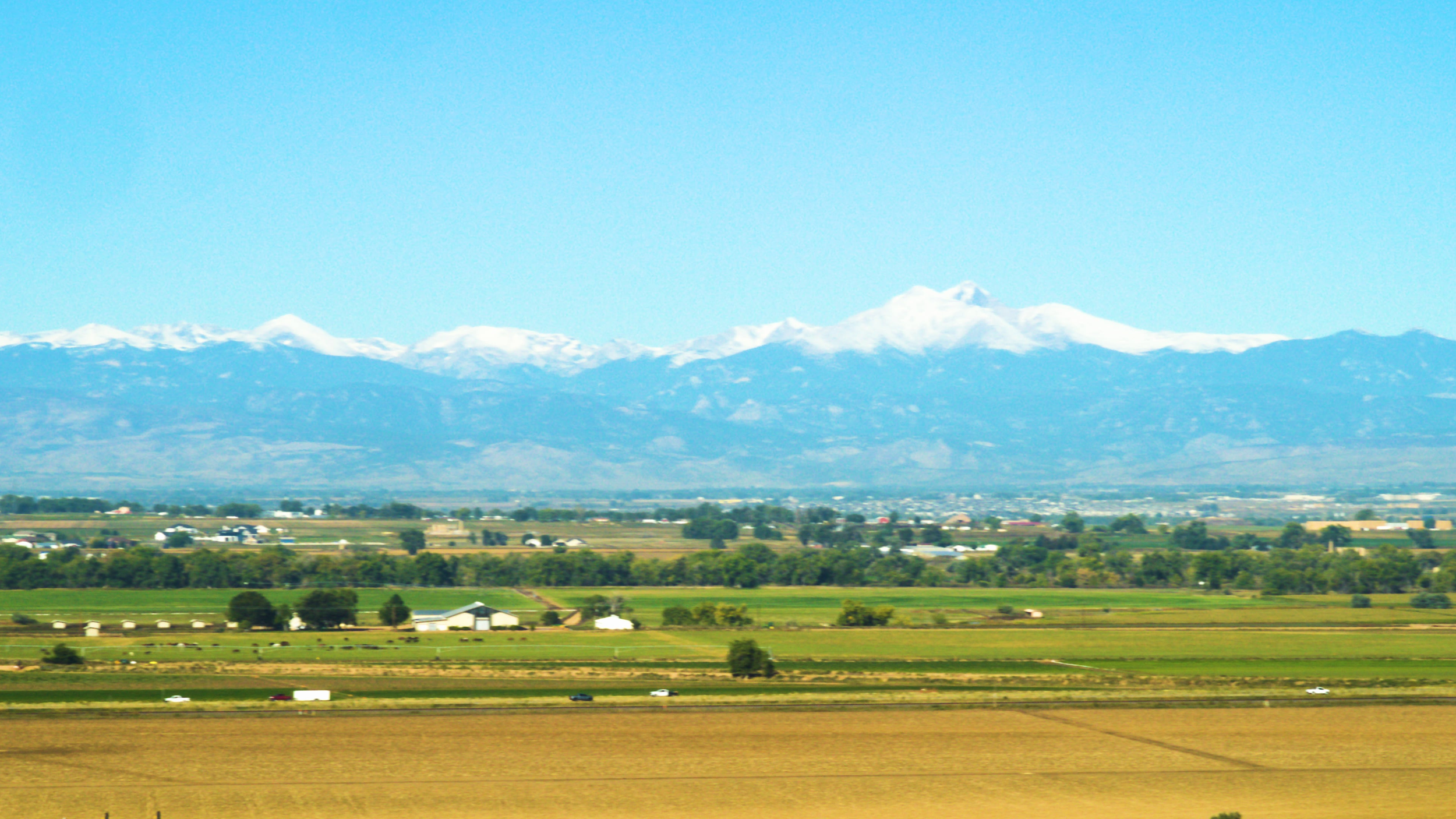
Trapper’s Point is a significant 190.5-acre residential development land opportunity located at the southeast corner of Highway 85 and County Road 26 in Fort Lupton, Colorado. Positioned on a scenic ridge with western views toward the Rocky Mountains, this parcel offers developers a unique site along a growing regional corridor just minutes from Platteville and Fort Lupton, approximately one half hour from Greeley and Denver. The property is currently zoned agricultural and currently Weld County would allow 4 acreage lots, but plans are to entitle the property for 36 ranchettes. Adjacent to a private airfield (LOI FAA ID 1CD2), with expansive acreage and flexible development potential, Trapper’s Point presents a compelling opportunity for residential or estate-style land development within a desirable Northern Colorado submarket. Whether pursued as a single large acquisition or broken into individual tracts, this land holding provides both scale and exposure for residential developers and investors.
Key Facts
Sale Price $2,857,500
Lot Size 190.5 Acres (8,298,180 SF)
Zoning Agricultural (Land 4147 Grazing Land)
Location SE Corner Hwy 85 & CR 26
Proximity 3.5 mi Platteville | 7 mi Fort Lupton (one half hour from Greeley and Denver)
Airfield Private airfield (LOI), FAA ID 1CD2
Property Description
The Trapper’s Point is a 190.5-acre residential development land opportunity along Hwy 85 at County Road 26 in Fort Lupton, Colorado. The property is currently zoned agricultural and is in the entitlement process to develop 36 ranchettes. Positioned on one of the highest ridges in Weld County with western views of the Rocky Mountains, the site offers quick access to Greeley and Denver via the Hwy 85 corridor.
Key Highlights
—190.5 acres at the SE corner of Hwy 85 & CR 26
—Ridge location with western Rocky Mountain views
—Being entitled for 36 ranchettes
—Weld County currently allows for four 40-acre home sites
—Privately owned airfield along south property line — FAA ID 1CD2
—Located in the Fort Lupton & Platteville intergovernmental area. To be annexed into Platteville
Location Overview
Trapper’s Point is a 190.5-acre residential development land opportunity located at the southeast corner of Highway 85 and County Road 26 in Fort Lupton, Colorado. Positioned on a ridge with western views of the Rocky Mountains, the property offers strong access within the Hwy 85 corridor, approximately 3.5 miles from Platteville and approximately one half hour from Greeley and Denver.
Land Opportunity
Total Size: 190.5 Acres (8,298,180 SF)
Asking Price: $2,857,500
Price Per Acre: $15,000/AC
Land Classification / Zoning Context: Agricultural (Land 4147 Grazing Land)
Development & Homesite Upside
Weld County allows for four 40-acre home sites
Concept supports additional upside potential by annexation into Platteville and increasing the number of homesites
Private airfield along the south property line — FAA ID: 1CD2
Located in the Fort Lupton & Platteville intergovernmental area
Key Highlights
SE corner of Hwy 85 & CR 26 (high-visibility corridor location)
Ridge setting with western Rocky Mountain views
Weld County allows for 40-acre homesites
Adjacent private airfield
Demographic Snapshot
The following demographic overview is provided for general context and is derived from 2020 ACS (U.S. Census).
Metric3 Miles7 Miles10 MilesPopulation1,25114,29038,780Average Household Income$71,711$64,461$73,483
Next Steps
Request additional due diligence materials
Schedule a tour of the property
Download the sales brochure for exhibits, maps, and supporting documentation